
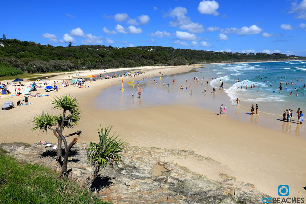
Perfect sunny day at Point Lookout Main Beach on North Stradbroke Island (this print is available in our online print gallery)
North Stradbroke Island, or 'Straddie' as it's affectionately known by locals, is located around 45mins from Cleveland by ferry and is a popular holiday and weekender destination for residents of Brisbane and beyond. Known for its amazing headlands, endless empty beaches, freshwater lakes, 4wd trails, camping grounds and coastal walks, Straddie is revered by its approximately 2,000 permanent residents as well as the 25,000 that descend on its shores during peak holiday periods. There's a variety of accommodation options on offer from beach and bush campgrounds to resort-style and privately-owned houses, bungalows and units, all of which offer a relaxed and laidback holiday setting for the whole family.
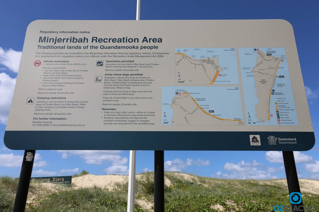
Traditional land of the Quandamooka people
The Quandamooka people refer to North Stradbroke Island as Minjerribah, which translates to 'Island in the Sun', a fitting name indeed. The Quandamooka are the traditional owners of the waters and island around Central and Southern Moreton Bay and are comprised of three main clans or tribes - the Nunukul, the Goenpul and the Ngugi. Archaeologists have found evidence of an indigenous population living on North Stradbroke Island for at least 21,000 years prior to white settlement and some people suggest even longer.
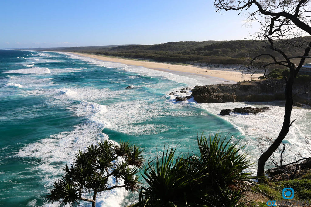
Looking south to eternity from Point Lookout
According to historians there have been references to European visitors to North Stradbroke Island as early as the 16th century with Dutch, French and Portugese possibly even mapping the coastline. In 1770, Lieutenant James Cook sailed past the island without stopping and gave the current name to its northern tip Point Lookout, and the next recorded interaction with the island is in 1803 when a group of local Aboriginal men helped explorer Matthew Flinders find fresh water around the Cylinder Beach/Adder Rock area.
Beautiful beaches are the norm on this island (this print is available in our online print gallery)
In 1827 Stradbroke Island was officially recorded as an island by then Surveyor-General John Oxley. According to Wikipedia Captain Henry John Rous, who had the title of Viscount Dunwich, commander of HMS Rainbow (the first British ship of war to enter Moreton Bay), named the island after his father the Earl of Stradbroke.

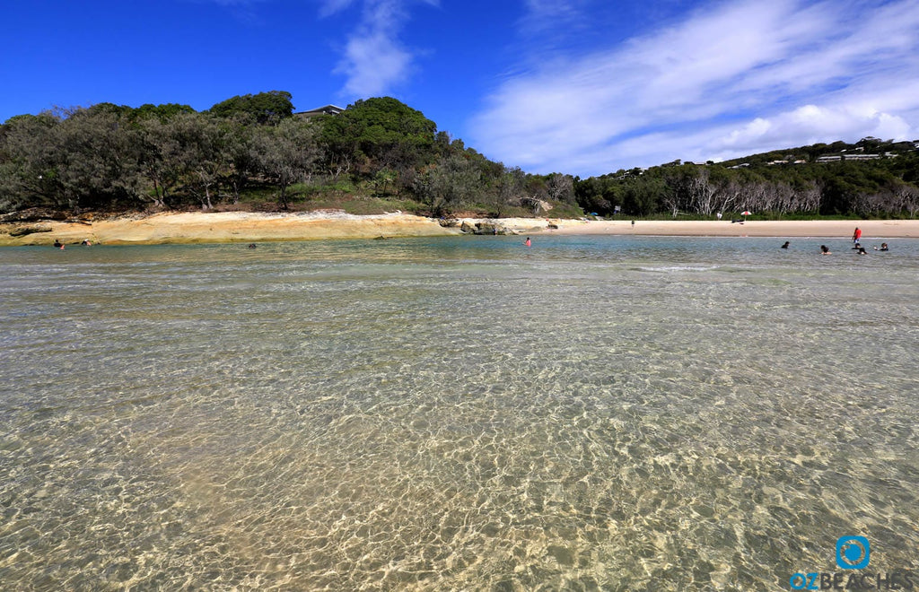
Perfect crystal clear waters of Cylinder Beach (this print is available in our online print gallery)
Over the past 190 years North Stradbroke Island has been the location of various different settlements. It was a military/stores depot and convict outstation (1827-1831), a Catholic mission (1843-1846), quarantine station (1850-1864) and benevolent asylum (1866-1946) and of course the tourist hotspot that it is today.
Despite its location, North Stradbroke Island was not immune from the perils of war. The American military installed a radio detection station on what is now Tramican Street at Point Lookout in 1942, and in 1943 a Japanese submarine torpedoed a hospital ship, the Centaur, off its coast and claimed the lives of 368 people (information courtesy of the North Stradbroke Island Historical Museum). Around 1964 North Stradbroke Island really started to take off as a tourist destination once the car ferry from Cleveland to Dunwich commenced and it continues to be a hugely popular holiday destination to this day.
There should be more of these signs on Australian beaches
According to the Quandamooka Yoolooburrabee Aboriginal Corporation, the Federal Court of Australia made two native title consent determinations recognising the Quandamooka People’s native title rights and interests over land and waters on, and surrounding North Stradbroke Island as well as some islands in Moreton Bay on 4 July 2011. The combined determination area is about 54,472 hectares, with native title existing over about 54,408 hectares of land and waters, including areas of national parks, reserves, unallocated State land and other leases.
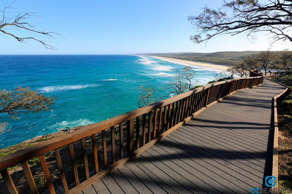
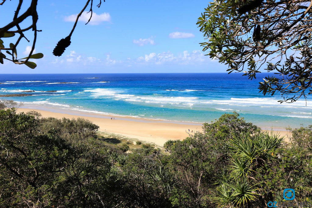
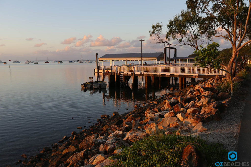
The boardwalk provides a great vantage point to spot whales, turtles, dolphins and more
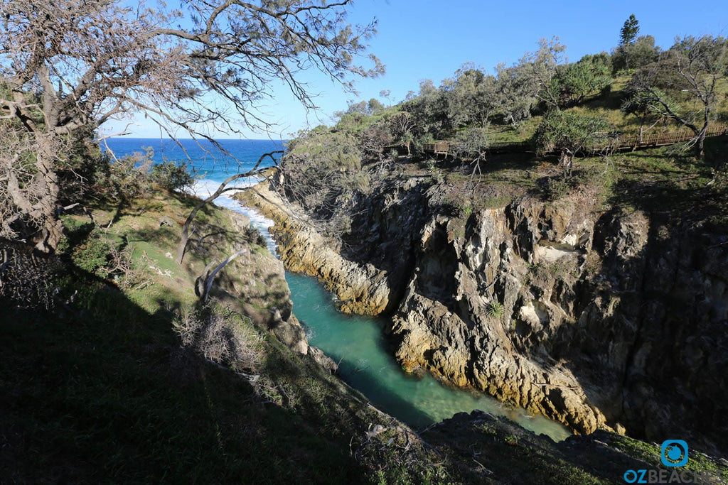
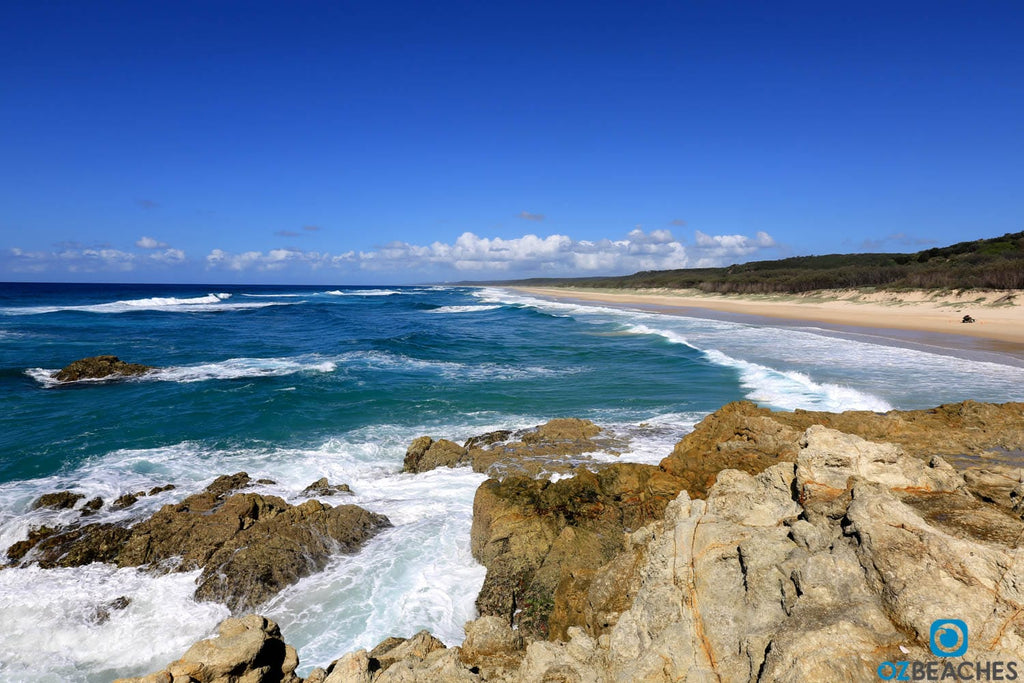
The views near the gorge itself are spectacular
The North Gorge Walk is well made and maintained
Being relatively high up on the cliff you get a great vantage point of the ocean below and it's one of the best spots in Australia to see dolphins, manta rays, sea turtles and whales in their element. The migratory whale season is between June and October each year, when you are almost guaranteed to see Humpback and other species of whales as they glide by.
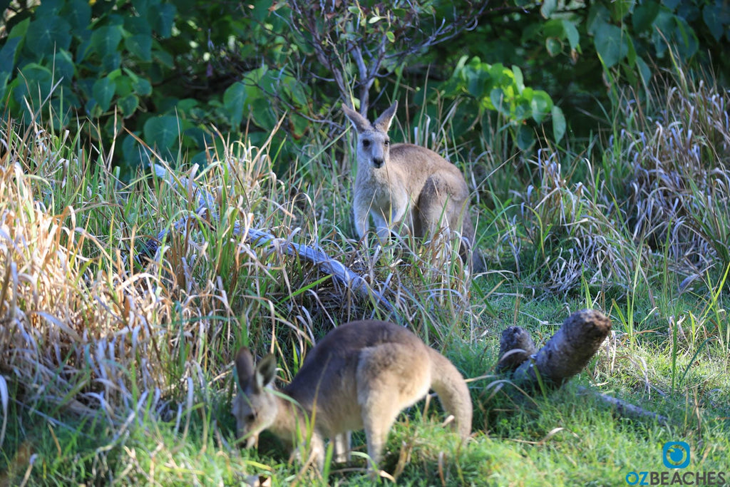 Kangaroos are common on North Stradbroke Island
If you love seeing animals in their natural habitat, North Stradbroke Island will certainly not disappoint. You can see everything from koalas to bandicoots, kangaroos and wallabies, echidnas and reptiles such as lizards, snakes, turtles and tortoises. Out in the water you have an excellent chance of seeing whales, dolphins, sea turtles, sharks, and possibly even dugongs if you're really lucky. That's not even mentioning the hundreds of different bird species that fly overhead. In fact there's so many species of animals on the island that the Department of Environment & Heritage Protection lists over 450 native species, 43 of which are either rare or threatened.
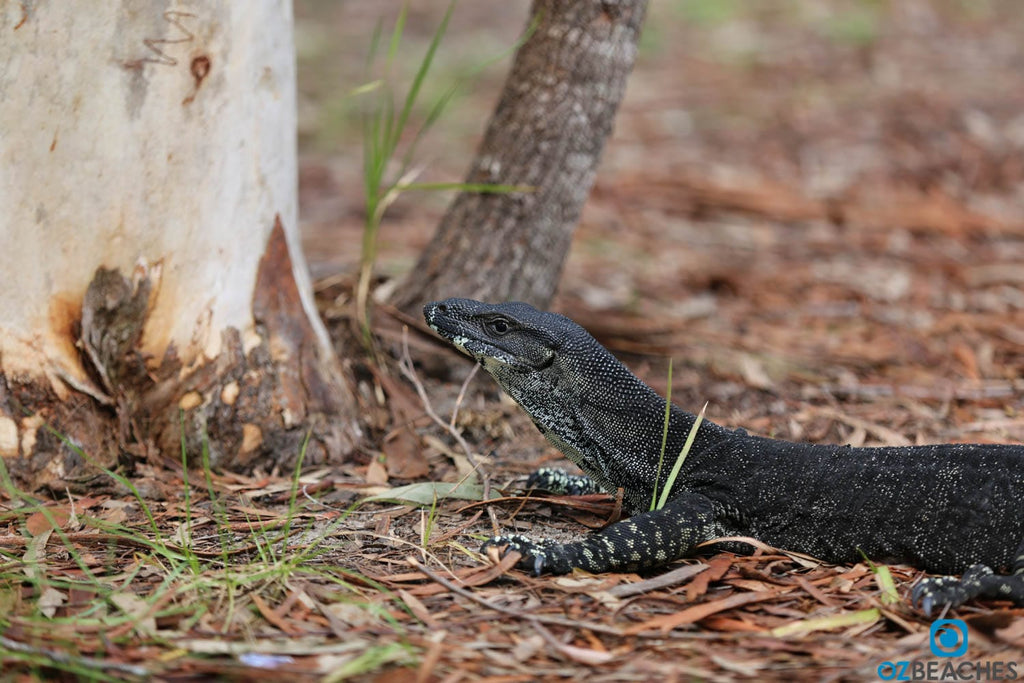
Large goannas are all over the place at Brown Lake
Amazingly the waters around North Stradbroke Island are home to 6 of the world's 7 species of marine turtles. From smallest to largest these turtles include the Olive Ridley, Loggerhead, Hawksbill, Flatback, Green and the giant Leatherback which can weigh up to 900kgs at 2m in length. The nesting season starts around November each year and runs through until March and a sad fact is that only 1 in 1,000 turtles survives until maturity.
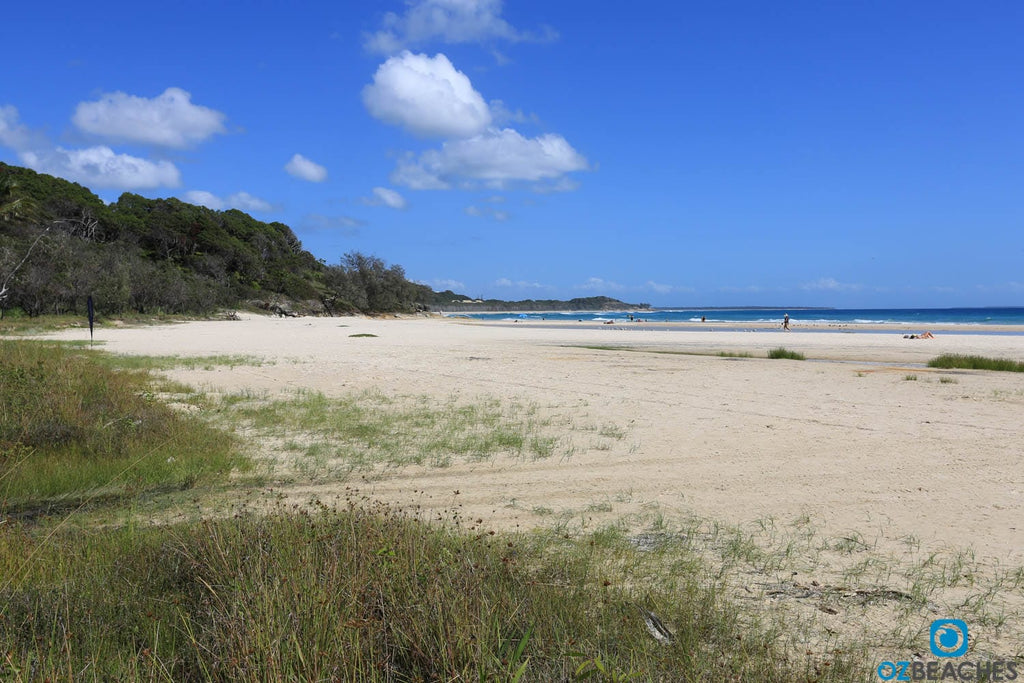
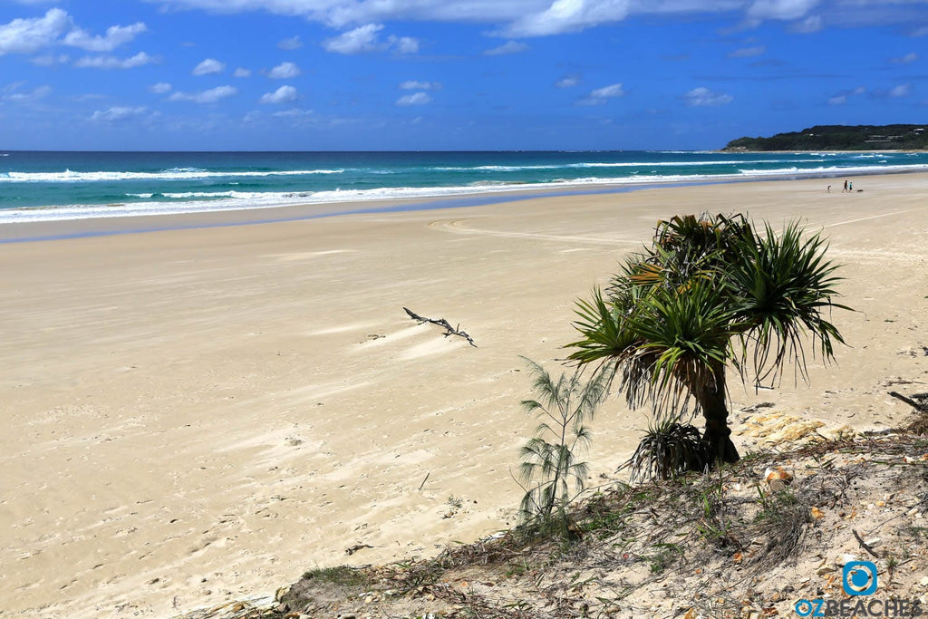
You'll feel like you're the only person on the whole island
At around 38kms long and 11kms wide at its widest point, North Stradbroke Island is the world's second largest sand island behind Fraser Island (also in QLD). Along with South Stradbroke Island and Moreton Island, North Stradbroke acts as a natural barrier between Moreton Bay and the Coral Sea.
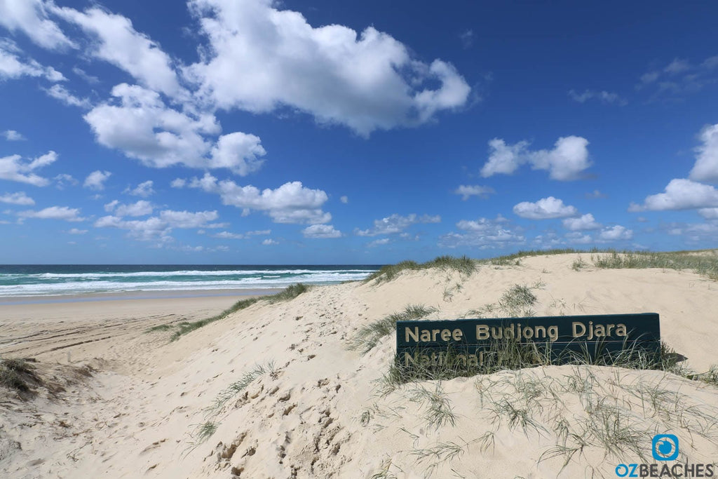
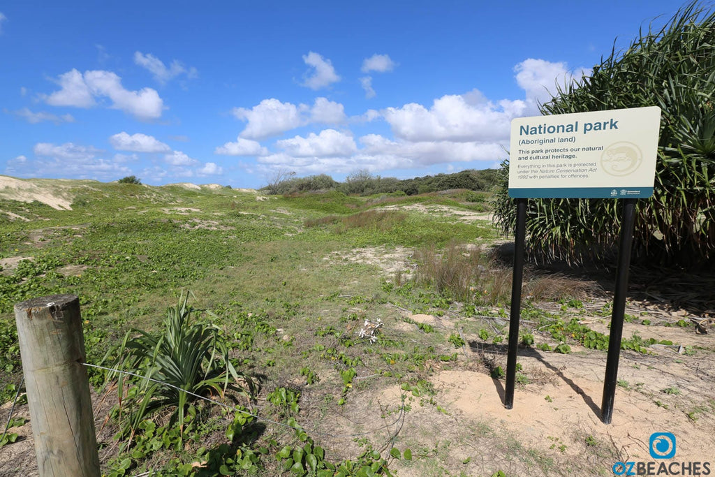
Naree Budjong Djara National Park
Sand mining began in the 1949 on the island and was initially focussed on the beachfront areas with allegedly little impact. As the mining operations moved closer towards the interior of the island in the 1960's and 1970's, the impact on the environment dramatically increased to the point where local community groups formed to protect it. Today however, and on a more positive note, legislation has been passed that ensures all mining operations will cease on North Stradbroke Island by 2019, and hopefully the island will begin to slowly repair itself over long period of rehabilitation.
4wd'ing is a popular activity on the island
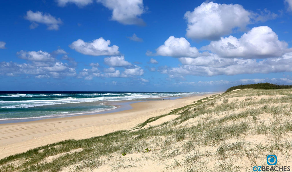
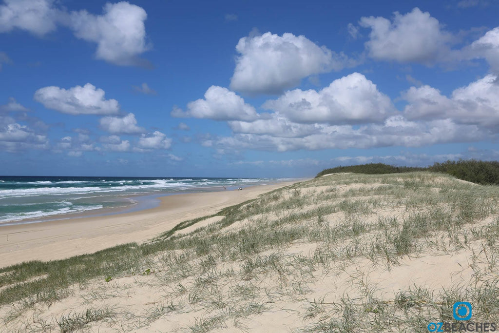
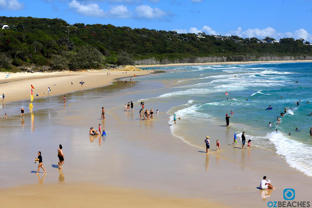
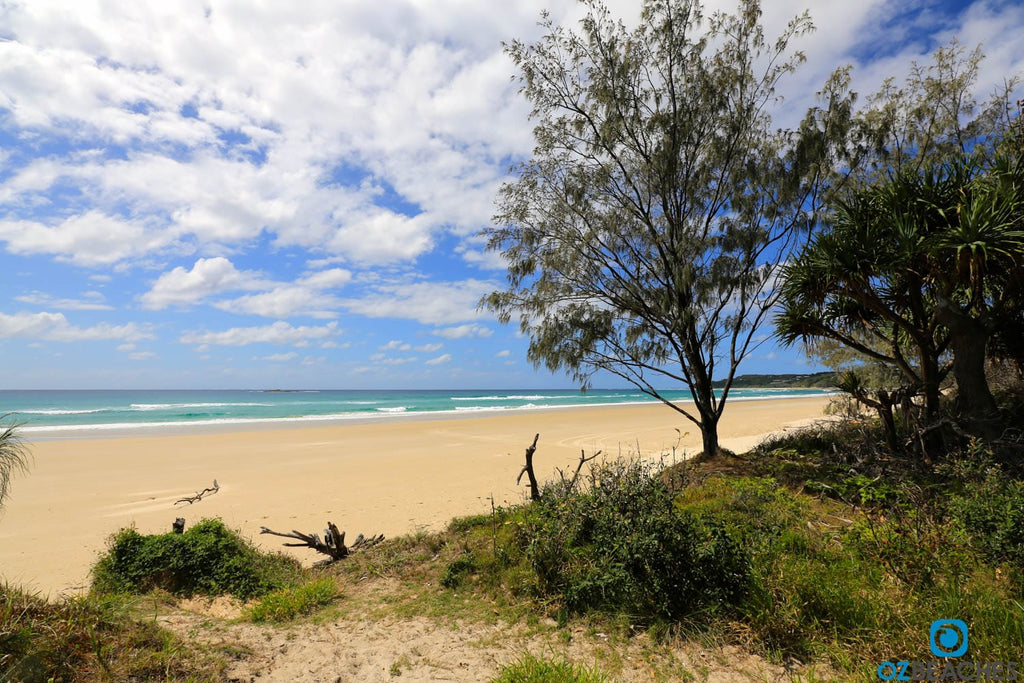
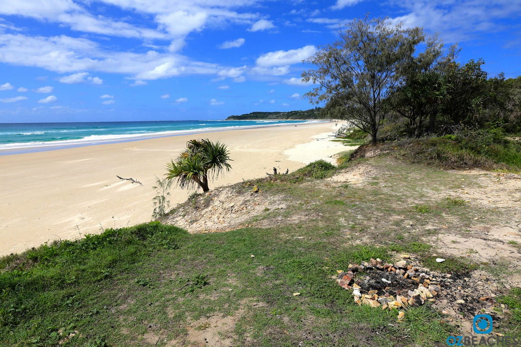
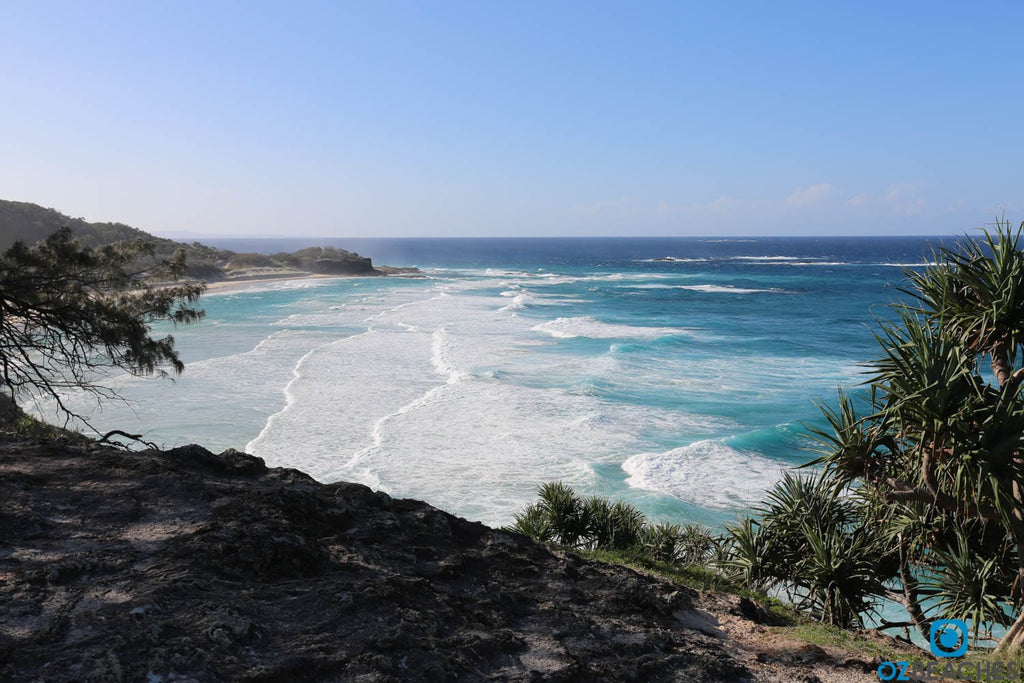
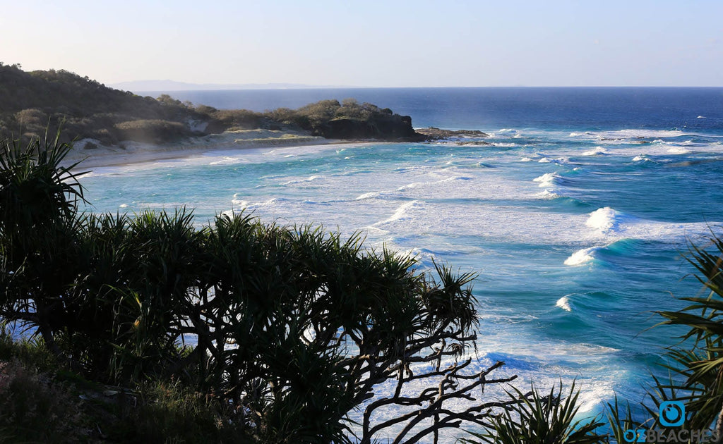
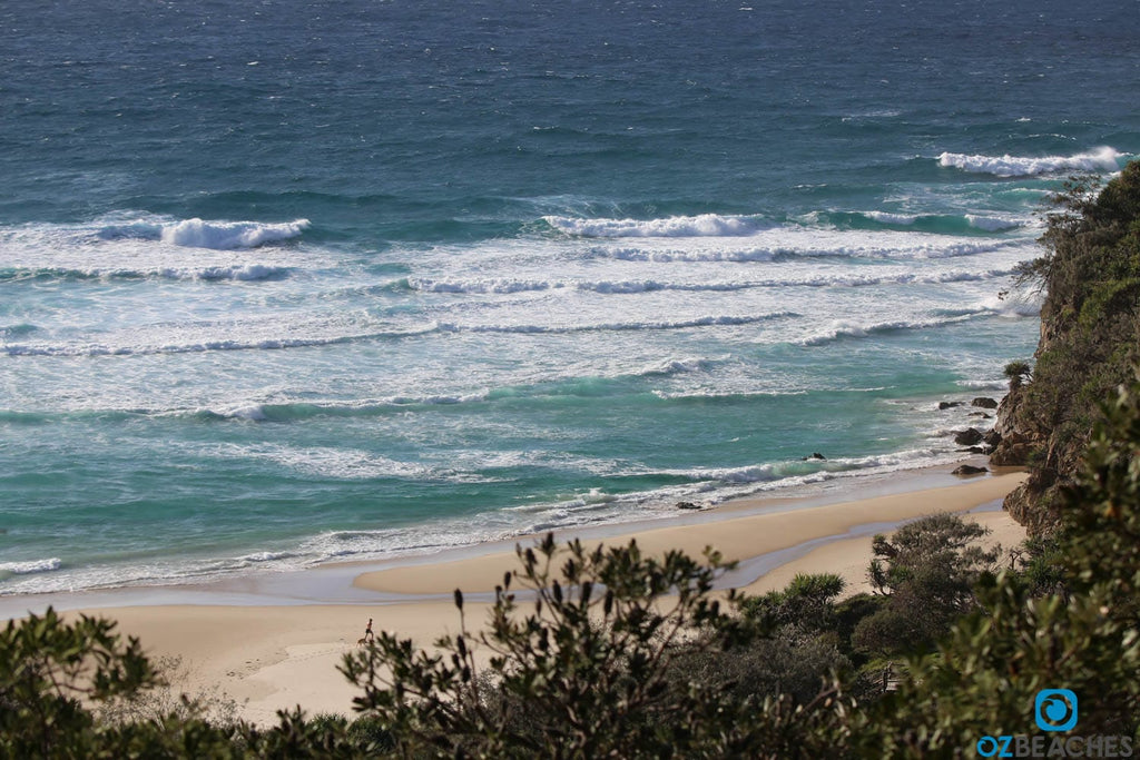
The beaches on North Stradbroke Island are truly amazing and it's rare to find such a diverse range of beach experiences in a relatively small area. You really are spoilt for choice and the island has something unique for everyone - renowned surfing beaches, protected swimming lagoons, wild and long empty stretches of sand where you won't find another soul, dramatic rocky headlands that provide unforgettable views of the coastline, calm and sheltered bays, freshwater springs that lead to the ocean and sand dunes as far as the eyes can see.
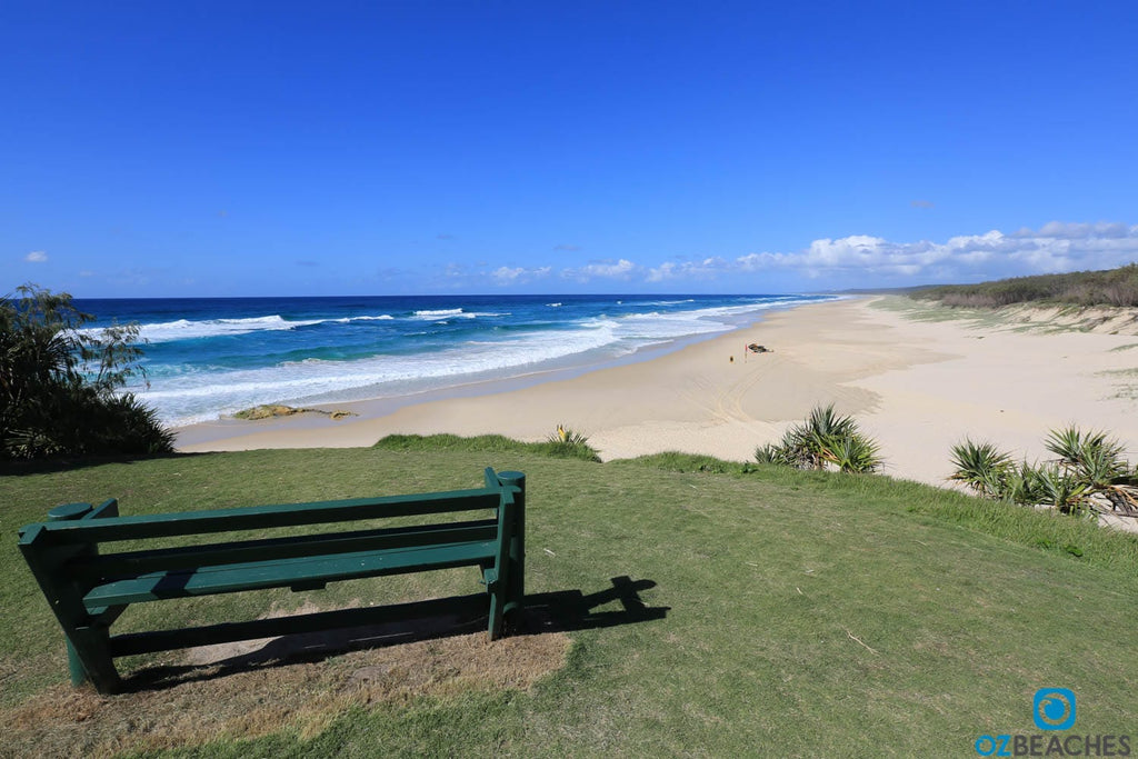
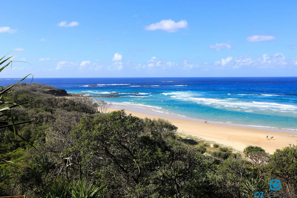
Great place to sit and take it all in - Main Beach, Point Lookout
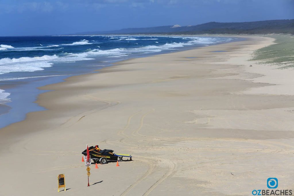
Point Lookout is the main surfing beach on the island and runs for about 33km south to the channel at Jumpinpin. It's east facing and fully exposed to all available swells and is best in west to north west winds. World Surfing League professional surfer Bede Durbidge is a local of Point Lookout and you only have to go to the local pub to see how many times he's won the local surfing contests.
Northern corner of Main Beach, Point Lookout
The ocean's rarely this calm at Main Beach, Point lookout
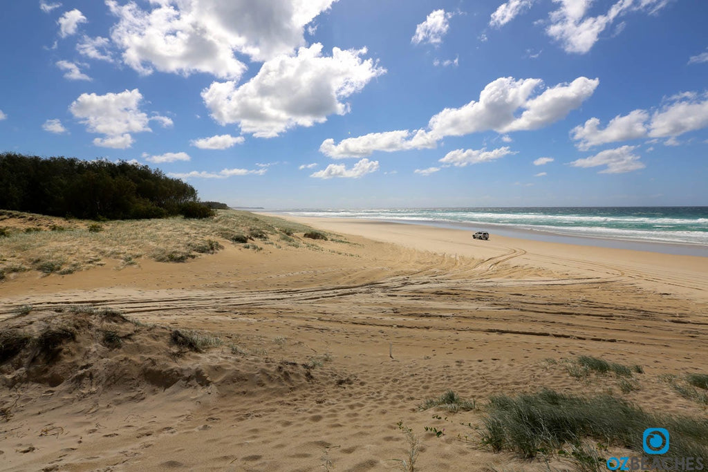
Four wheel drives are the perfect way to get around the Island
Cylinder Beach is one of the most scenic beaches on the island and it's usually calm and crystal clear waters make it hugely popular with families. It gets its name from the acetylene gas cylinders which were used for lighting purposes while constructing the Point Lookout Lighthouse in 1932 that were landed on the beach. The beach itself is north facing which means it basks in the sun all day and the surrounding headland ensures it's protected from most winds.
Cylinder Beach is popular with families and school holidays
How inviting does this look!
Cylinder Beach is rarely uncrowded during holiday periods
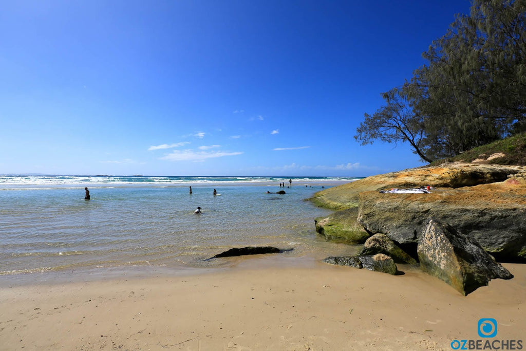
Not a bad spot for a swim
Looking down on the happy holiday makers at Cylinder Beach
Home Beach is a popular spot for those with dogs as it's one of only two places on the island that is recognised as an off-leash exercise area. The dog-friendly area is between Rocky Point and Rocky Headland which is located in front of Point Lookout Hotel. There are little to no crowds on this beach and it's a great place to escape too if the holiday crowds at nearby Cylinder Beach get a bit much to handle.
Home away from home - Home Beach
You'd be hard pressed finding another person here
Follow this track if you want a beach to yourself
Such a lovely beach with no one in sight - Home Beach
As legend has it, Frenchmans Beach is named after four men who sailed west from French-speaking islands in the South Pacific in the early 19th century and landed on the beach (and apparently descendants of these four still live on the island today). Frenchmans Beach is around 500m long and faces due east, which means its fully exposed to all available winds and swell. The surf here is fairly consistent, but as it's exposed the winds can affect the waves at times. There's a nice lagoon near the shore which is great for swimming, and the stairs from the top of the hill down to the beach are rather steep so make sure you leave enough energy in the tank for the return journey.
A bit of a walk down and back up but worth the trip
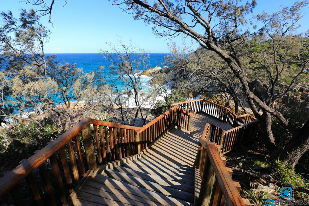
View of Frenchmans Beach from the North Gorge Walk
Frenchmans Beach, North Stradbroke Island
Oui oui, I'll be back again to Frenchmans Beach
As the story goes, Deadmans Beach apparently gets its name from a skeleton and boot that was found here back in 1956, believed to belong to a member of the shipwreck the Prosperity. Deadmans Beach is around 600m long and faces north and provides some shelter from strong southerly winds. The beach is a popular beach and rock fishing spot and can produce decent right hand waves when conditions are right.
No skeletons this time - Deadmans Beach
It's not often you think of the colour brown as beautiful, but Brown lake is certainly that. Also known as Lake Bummiera, Brown Lake is located around 3.5kms from Dunwich and is a popular swimming and picnic spot. The lake gets its unique brown colour from the native Teatrees that surround it. Keep an eye out for large goannas, kangaroos and even snakes.
A typical sunny day at Brown Lake
You can tell where it gets its name from
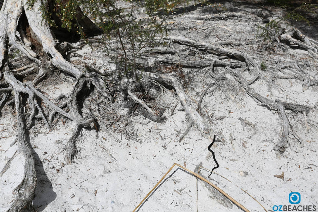
Keep an eye out where you walk, I nearly trod on this little guy
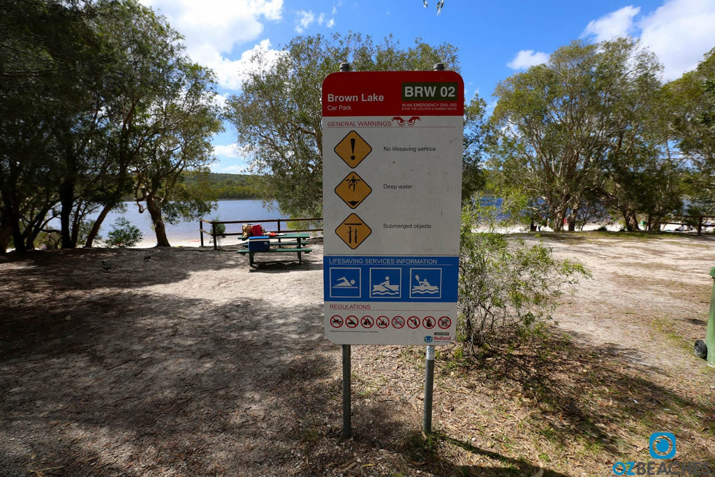 Parking area at Brown Lake
According to the North Stradbroke Island Historical Museum, Amity Point was originally known as Pulan by the Nunukul people and was home to an Aboriginal population of over 100 at the time of settlement. In 1825 a pilot station was established to guide ships travelling to the Moreton Bay penal settlement via the South Passage, and this was North Stradbroke Island's first non-indigenous settlement (closed in the 1840s). In more reecent times tragedy struck at Amity Point on January 7 2006 when a young woman was attacked and killed by up to three sharks as she swam 15m offshore. A man bravely swam out during the attack to try and save her but her wounds were too severe. She was brought back to shore but sadly was pronounced dead a few hours later. There's a netted swimming area at Amity Point if you want a swim which is probably a safer option.
Sunsets are beautiful at Amity Point
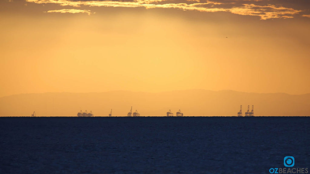
Not sure if these are cranes at the Port of Brisbane, or dinosaurs...
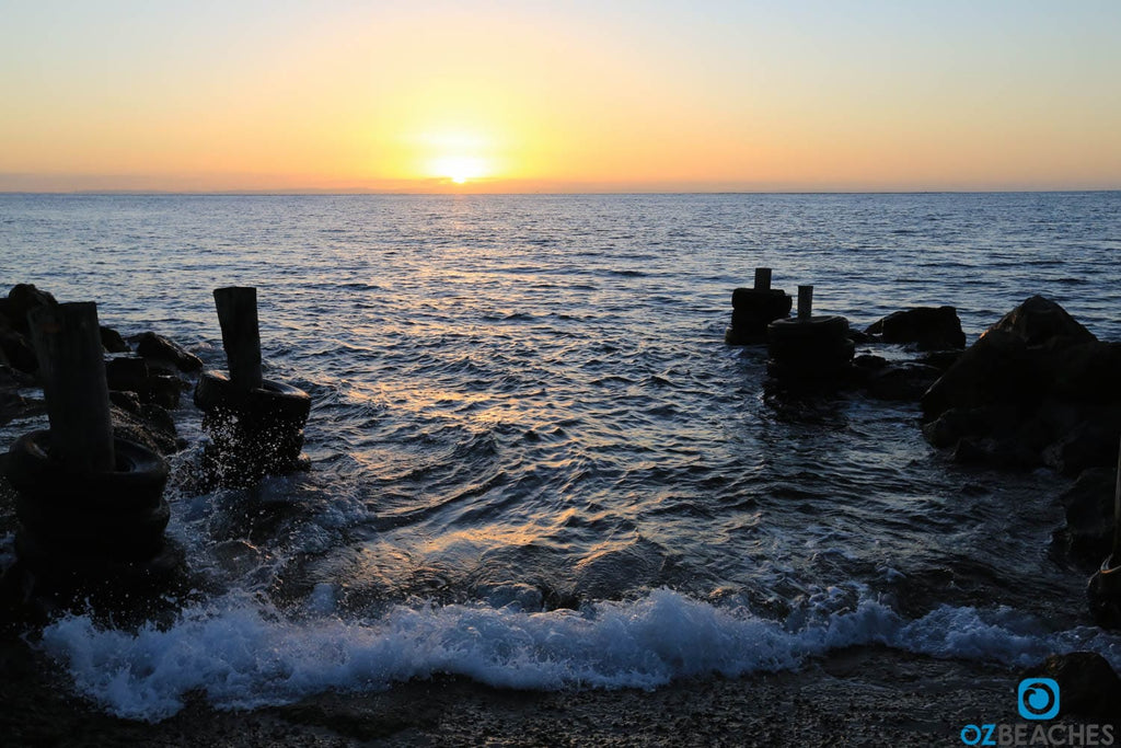
Evening glass off while the sun sets
Don't swim here around this time, bait fish are everywhere
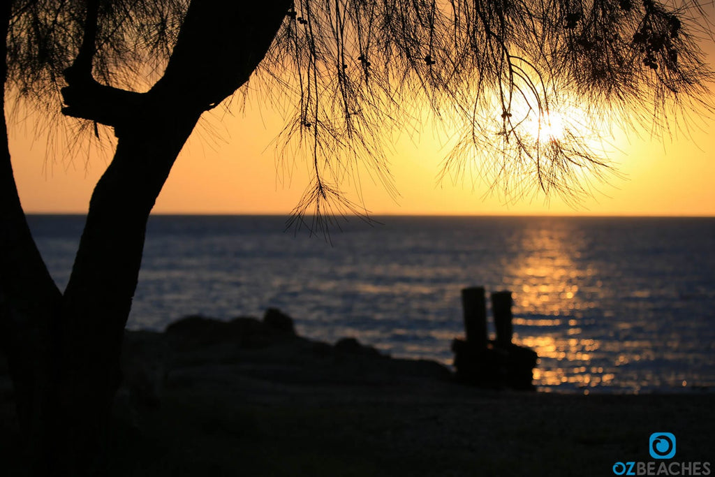
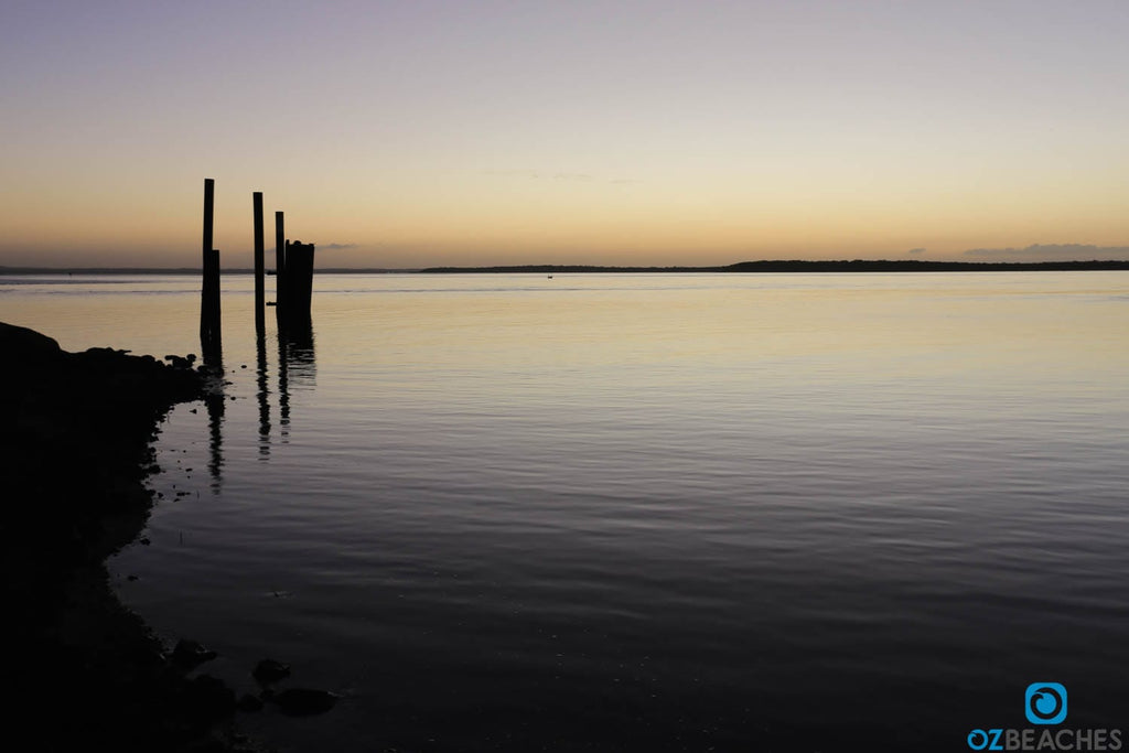
Dunwich is the place where the ferry lands and is your entry and exit point on North Stradbroke Island. If you're bringing your vehicle over from the mainland make sure you don't drink above the legal limit as the police with an RBT unit will be the first people to greet you on the island. There are a few shops around Dunwich if you've got some spare time, and the local cemetery is worth a visit to see historic headstones form the early 1800's. There's a club right on the water that's a good spot to stop in for a drink, and the sunsets here can be amazing.
Beautiful end to the day at the ferry terminal on North Stradbroke Island (this print is available in our online print gallery)
North Stradbroke Island is around a 40min drive east of Brisbane plus an additional boat ride across Moreton Bay. There are a few options for getting to the island:
1, Vehicle ferry from Cleveland to Dunwich - Stradbroke Ferries departs from Cleveland (mainland side) every day from 5:30am onwards until around 7:00pm, and arrives at Dunwich (island side) approximately 45mins later. The returning ferry departs Dunwich and arrives back at Cleveland up until about 6pm. Prices range from around $50 to $100 each way depending on the time you leave.
2, Water taxi - if you don't plan on taking your car or are just visiting for the day, an affordable option is to take a water taxi. These only take around 25mins to the island and costs range from $20 upwards.
3, Your boat - for the lucky ones amongst us, this would be the ideal way to get to the island as you could take in all the sights and sounds along the way at your own pace.
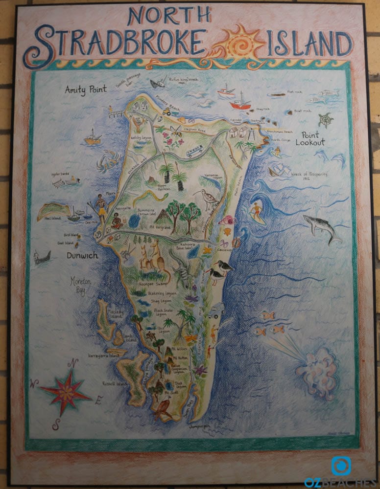
Artists impression of North Stradbroke Island
South Stradbroke Island is the next island south from North Stradbroke Island
I hope you enjoyed reading this article as much as I enjoyed writing it. North Stradbroke Island is a true island paradise and an ideal spot to visit if you want a quiet weekend away from it all. The island has a warm and welcoming feel to it and everything moves at a much slower pace which is perfect for those wanting to immerse themselves in nature and get some alone time. With its endless beaches, beautiful headlands and walks, great four wheel driving and camping, and am amazing array of wildlife and coastal views, North Stradbroke Island will continue to be a favourite holiday destination and we are looking forward to all mining operations ceasing on the island in 2019.
All photos in this article are available for purchase in various sizes as high resolution acrylic glass or canvas prints, and are available for licensing purposes for media and marketing/promotional material. The photos you see here have been compressed for optimal online user experience, which means we've intentionally reduced the file size and quality of each image to ensure the pages you visit load faster.
Any printed reproduction of the photos you see on OZBEACHES would be done using the original 20+ megabyte RAW files, with the additional layer of having a professional graphic designer personally inspect each image and optimise for print. The OZBEACHES watermark would be removed and would not be visible on your print. If you have any questions about this process, please email me (Adam) and let me know which photo you're interested in by quoting the caption beneath it. Alternatively you can check out our featured images in the print gallery.
If you think North Stradbroke Island is a place you'd like to visit with your friends, why not share this article with them via one of the social links below. I want to help people (including you!) find their dream Australian beach, and the more information we share together will ultimately help us all in achieving that goal. I hope you enjoy your search.
Cheers,
Adam
Sign up to get the latest on sales, new releases and more …
© 2024 OZBEACHES.